Thank you, National Weather Service, your tools are very beneficial for an outdoor runner!
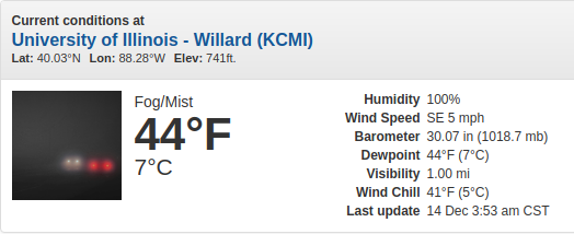
I often post the weather summary image to share what my run was dealing with outside that day, but there are several other tools I use to help determine what to wear and which route to take, plus how I may need to adjust based on forecast conditions.
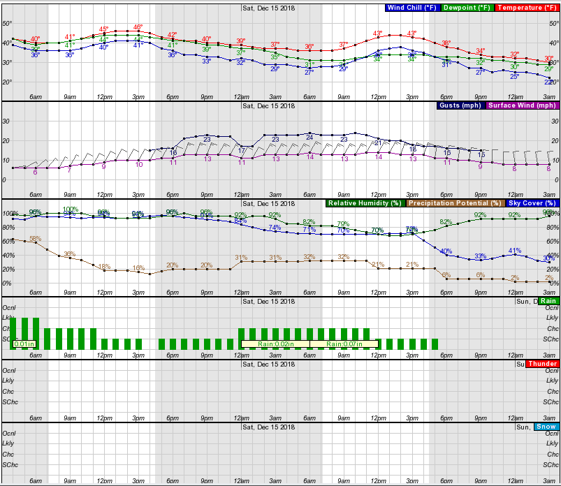
Consider this chart data:

When I first saw this chart it was overwhelming and a bit confusing, now it’s like a breath of fresh air. Why? Because it tells a story. It’s like a psychic telling the present and future. While this data cannot be 100% accurate to my 10-mile radius, it certainly provides data with a greater than 80% probability.
Getting the 10,000-foot view (or more). I like these radar/satellite maps as they provide a perspective of what is happening around the area and what is coming. Place the map in a “loop,” and you get a sense for the direction of weather pattern travel.
I have two outdoor thermometers reporting the temps from the North and South sides of my home. I use these as a local cross-check to the online NWS reports. However, I live in a suburban area with houses around me, this can create a vast temperature and windchill variation versus the open fields when I get out of town. It’s all part of being prepared!


Leave a Reply